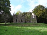
Ferme dite Les Siyeres,
Plan cadastral de 1836.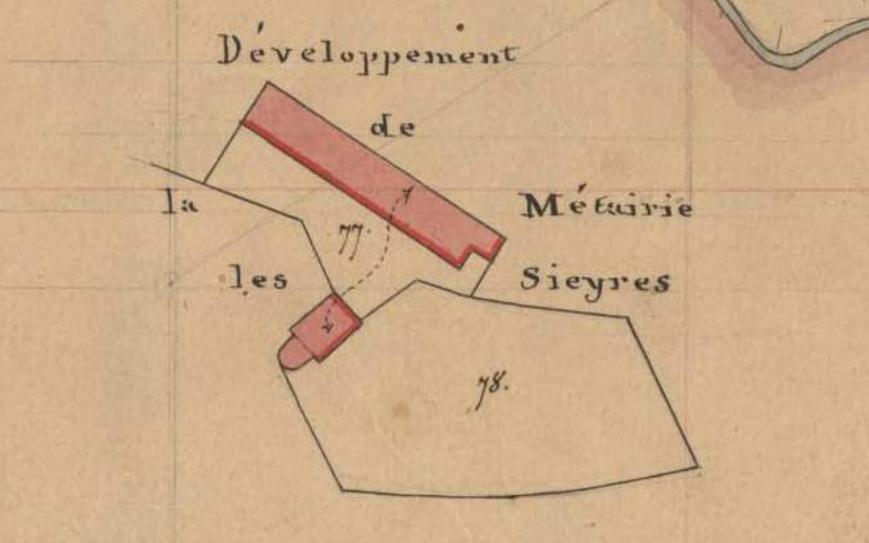
Immatriculation
IVR91_20153404496NUCA
Auteur de l'illustration
Copyright
- (c) Parc Naturel Régional du Haut-Languedoc
- (c) Inventaire général Région Occitanie
Année de prise de vue
2014
Diffusion
communication libre, reproduction soumise à autorisation
Type
phototype numérique
Besoin d'informations sur cette illustration ?
Nous contacter
-
Dénomination
- ferme
-
Titre courantFerme dite Les Siyeres
-
Légende génériquePlan cadastral de 1836.
-
Aire d'étudeParc Naturel Régional du Haut-Languedoc
-
CommuneFraisse-sur-Agout
-
Lieu-dit
- Les Siyeres